Planning to visit one of our Conservation Areas? Plan your trip by downloading the PDF or mobile map you’ll need during your visit and take a look at any upcoming service disruptions.
Please follow all park rules during your visit and remember that amenities, such as washrooms and pavilions, are only open from mid-June to mid-October.
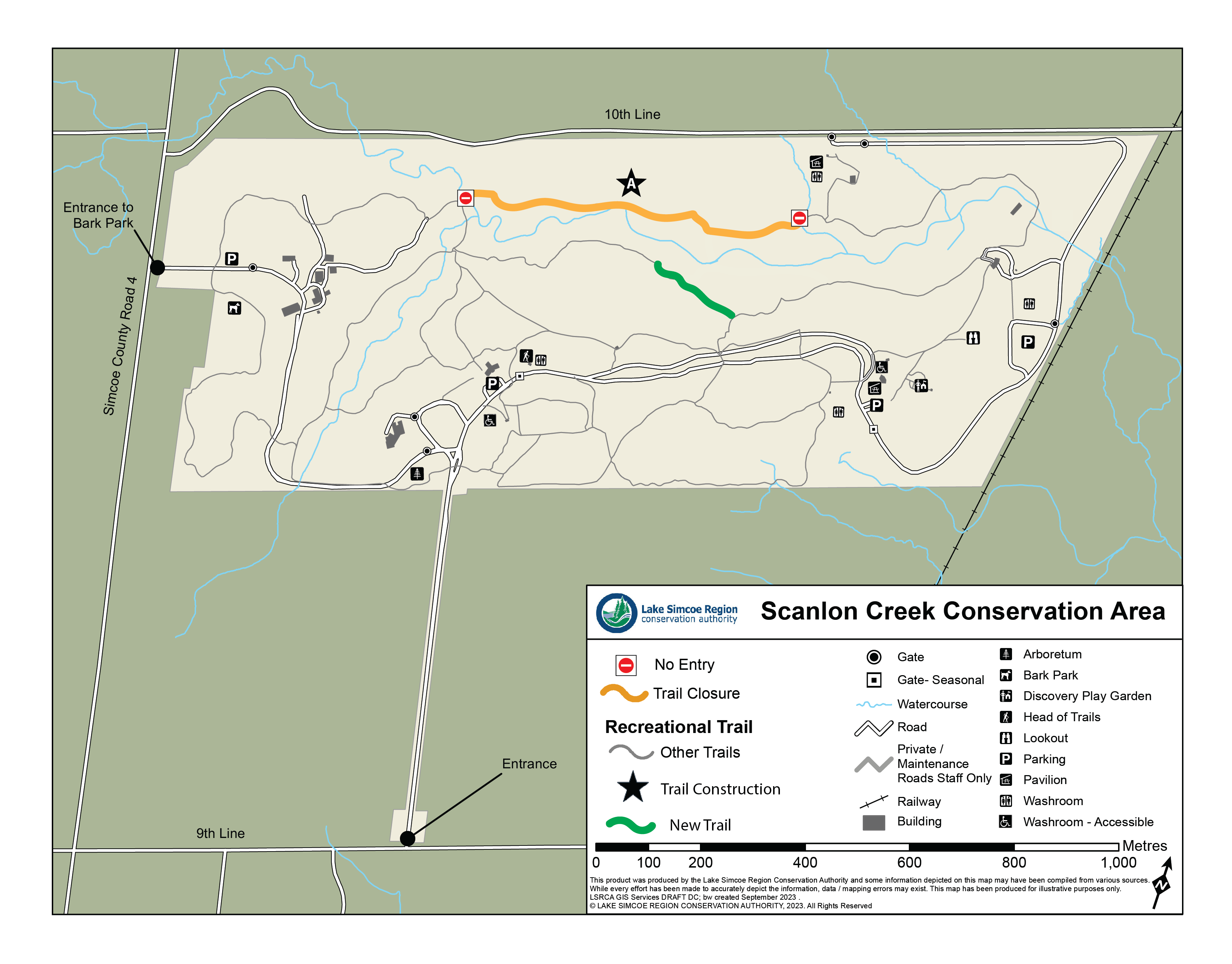
Closures
Scanlon Creek's Discovery Play Garden closed during Summer Programming
To accommodate Outdoor Education Programming, the Discovery Play Garden will be closed to visitors from 8am to 4pm Monday to Friday for the following weeks:
July 15 to 19
July 22 to 26
August 12 to 16
August 19 to 23
August 26 to 30
Kingfisher Trail at Scanlon Creek partially closed until October 2024
A section of the Kingfisher Trail (Location A on map) at the Scanlon Creek Conservation Area is temporarily closed until October 2024 for trail redevelopment and improvements. Work will include:
Surface enhancements
Grading adjustments
Culvert installations
Rehabilitation efforts
And planting native trees and shrubs for trail and bank stabilization
Due to the sensitive and wet conditions of this part of the Kingfisher Trail and ongoing construction, visitors are asked to avoid the redevelopment area.
For your safety, please obey all trail closure signs, and stay clear of the work zone. As there is no access to the other side of the trail, we recommend using an alternate route.
If you have any questions about the trail redevelopment, please contact: Dan Andrews at d.andrews@LSRCA.on.ca
Simply download the app on your smartphone and use it when you visit. It’s that easy! Once the map is downloaded, you won’t have to use your data when you hit the trails.
How to use Avenza:
Download the Avenza app on your mobile phone.
Open the app (when prompted, consider allowing Avenza to access your location for optimal use).
Create an account (or click the small white X in the top right corner to skip this step).
Tap the Store button on the bottom of the page.
Click on the search bar at the top of the page.
In the location box, choose “Current Location” if you are looking for conservation areas that are closest to you, or change to “Any Location” to see all our available maps.
In the Keywords box type in LSRCA, then click search.
When you find the map you are looking for, tap the “Free” button, then tap again on “Download?” This will add the desired map to your app.
Click on My Maps (bottom left icon), select your map and hit the trails! Once you install your map, you no longer need access to data.
Our maps may change over time! To ensure you have the latest download, join our email list. We’ll send you an email when we release a new version of the map.